UN
1 Brewery Lane
£ 214,000
Description
We don't have a Description for this property.
- Bedrooms
- 2
- Bathrooms
- 0
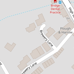


Leaflet © OpenStreetMap contributors
The heatmap indicates the level of crime in the area. The color of the heatmap indicates the crime severity and recency.
Metrics Year-on-Year
- Average area value
- 262,768.00 £Increased by 11.50 %
- Average area rental value
- 1,117.00 £/moIncreased by 4.78 %
- Est rental Yield
- 5.10 %Decreased by 6.08 %
- Crime Rate
- 87.00 %Unchanged by 0.00 %
from 235,661.00 £
from 1,066.00 £/mo
from 5.43 %
from 87.00 %
Nearby Schools
| Name | Type | Ofsted | Distance |
|---|---|---|---|
| Bridge And Patrixbourne Church Of England Primary School | Voluntary Controlled School | Good | 0.38 KM |
| St Anselm'S Catholic School, Canterbury | Academy Converter | Good | 3.43 KM |
| Simon Langton Girls' Grammar School | Voluntary Controlled School | Good | 3.87 KM |
| Pilgrims' Way Primary School | Academy Sponsor Led | 4.20 KM | |
| Cats Canterbury | Other Independent School | 4.48 KM |
Images
Nearby Streets
| Name | Average Price | Average Sqft | Distance |
|---|---|---|---|
| Bridgeford Way | £ 130,500 | 0 | 0.00 KM |
| Meadow Close | £ 673,333 | 0 | 0.00 KM |
| Beech Hill | £ 0 | 0 | 0.00 KM |
| St. Mary's Road | £ 725,000 | 0 | 0.00 KM |
| Renville Farm Road | £ 0 | 0 | 0.00 KM |
Nearby Transport
| Name | NLC | TLC | Distance |
|---|---|---|---|
| Bekesbourne | 5198 | BKS | 2.21 KM |
| Sturry | 5029 | STU | 6.26 KM |
| Canterbury East | 5164 | CBE | 6.37 KM |
| Canterbury West | 5007 | CBW | 7.06 KM |
| Adisham | 5160 | ADM | 8.16 KM |
Nearby Listings
| Address | Price | Type | Score | Distance |
|---|---|---|---|---|
| Bridge | £ 265,000 | BUY | 6 / 10 | 0.01 KM |
| Brewery Lane, Bridge | £ 240,000 | BUY | 5 / 10 | 0.03 KM |
| High Street, Bridge, Canterbury | £ 350,000 | BUY | 6 / 10 | 0.10 KM |
| High Street, Bridge, Canterbury, Kent, CT4 | £ 500,000 | BUY | 7 / 10 | 0.12 KM |
| High Street, Bridge | £ 325,000 | BUY | 6 / 10 | 0.12 KM |
Nearby Properties
| Address | Price | Distance |
|---|---|---|
| 5 Brewery Lane | £ 150,000 | 0.00 KM |
| 3 Brewery Lane | £ 130,000 | 0.00 KM |
| 19 Brewery Lane | £ 180,000 | 0.00 KM |
| 2 Brewery Lane | £ 480,000 | 0.00 KM |
| 12 Brewery Lane | £ 260,101 | 0.00 KM |